2023 Map of Gauley Bridge
USGS Topo · Published 2023About this map
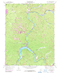
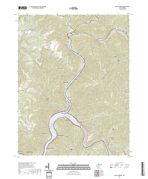
Kanawha Falls marks the dramatic hydrological convergence where the New River meets the Gauley River to form the Kanawha River. This survey documents the complex transportation and settlement patterns dictated by the steep topography of the Allegheny Plateau. The area is anchored by Gauley Bridge and Glen Ferris, with rail-related infrastructure visible at KM Junction. Inland from the riverbanks, the map reveals a high density of ancestral sites, including the Abbott-Huddleston Cem and Rich Creek Cem. Historic hollows like Whiteface Hollow and Log Chute Hollow reflect the region's timber and mining heritage. The presence of settlements such as Boonesborough and Chimney Corner alongside traditional travel routes like the Midland Trl illustrates the enduring human footprint in this river-driven economy.
Find a feature on this map
107 named features on this map. Tap any name to fly to it.
Don’t see what you’re looking for? This feature index may not catch every label — zoom into the map to look around manually.
Map Details
Editions of this 2023 Gauley Bridge Map
This is the sole edition of this map. No revisions or reprints were ever made.