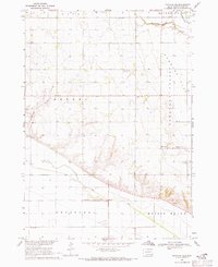
1969 Map of Gayville NE
USGS Topo · Published 1971About this map
Westreville serves as a central point in this late-1960s agricultural landscape, situated where the terrain transitions from the lowlands of Cabbage Flat and Pleasant Valley toward the prominent height of Spirit Mound. The map reveals a deeply rooted rural community organized around historical townships like Bethel and Meckling, where local life is anchored by civic and religious landmarks including the townhall, Union Ch, and several well-distributed burial grounds such as St Patricks Cem and South Lodi Cem. Water management is a defining characteristic of the region, evidenced by the channelized course of Clay Creek and the presence of a flowing well, alongside the natural meandering of the Vermillion R. The inclusion of a sandpit and Norwegian Gulch highlights the localized extraction and drainage patterns that shaped the county's development during this era.
Find a feature on this map
21 named features on this map. Tap any name to fly to it.
Don’t see what you’re looking for? This feature index may not catch every label — zoom into the map to look around manually.
Map Details
Editions of this 1969 Gayville NE Map
This is the sole edition of this map. No revisions or reprints were ever made.
Other maps of this area

1897 · Canton
USGS Topo · 1:125,000

1898 · Parker
USGS Topo · 1:125,000

1898 · Elk Point
USGS Topo · 1:125,000

1900 · Canton
USGS Topo · 1:125,000

1901 · Elk Point
USGS Topo · 1:125,000

1907 · Elk Point
USGS Topo · 1:125,000

1955 · Sioux City
USGS Topo · 1:250,000

1955 · Sioux Falls
USGS Topo · 1:250,000

1957 · Gayville
USGS Topo · 1:24,000

1958 · Sioux City
USGS Topo · 1:250,000
Featured Places
- Star Township, SD
- Riverside Township, SD
- Bethel Township, SD
- Pleasant Valley Township, SD
- Spirit Mound Township, SD