
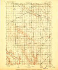
1898 Map of Parker
USGS Topo · Published 1898About this map
Parker serves as a central hub on this late 19th-century survey of southeastern South Dakota, where the Chicago and Northwestern and the Chicago Milwaukee and St. Paul railroads intersect. This rail network defined the early development of Turner County, connecting grain-growing settlements like Marion, Hurley, and Viborg. The landscape transitions from the flat river plains of the East Fork Vermilion River and West Fork Vermilion River to the prominent relief of Turkey Ridge, which dominates the southwestern portion of the quadrangle. Small agrarian communities such as Idylwilde, Spring Valley, and Center Point are scattered throughout the townships, while Swan Lake and Mud Lake provide notable water features in an otherwise well-drained prairie. The map captures a moment when the transition from open territory to structured agricultural townships was complete, but before the road network was fully formalized.
Find a feature on this map
55 named features on this map. Tap any name to fly to it.
Don’t see what you’re looking for? This feature index may not catch every label — zoom into the map to look around manually.
Map Details
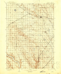
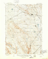
Editions of this 1898 Parker Map
4 editions found
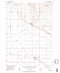
Other maps of this area

1897 · Canton
USGS Topo · 1:125,000

1898 · Olivet
USGS Topo · 1:125,000

1898 · Elk Point
USGS Topo · 1:125,000

1899 · Alexandria
USGS Topo · 1:125,000

1900 · Canton
USGS Topo · 1:125,000

1901 · Elk Point
USGS Topo · 1:125,000

1907 · Elk Point
USGS Topo · 1:125,000

1955 · Sioux City
USGS Topo · 1:250,000

1955 · Sioux Falls
USGS Topo · 1:250,000
1957 · Gayville
USGS Topo · 1:24,000