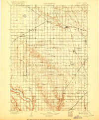
1898 Map of Parker
USGS Topo · Published 1917About this map
The East Fork Vermillion River and its western counterpart converge just south of Parker, the central hub of this late-nineteenth-century prairie landscape. Surveyed in 1896, the map captures a period when the expansion of the Chicago Milwaukee and St. Paul Ry. and the Chicago and Northwestern Ry. dictated the growth of towns like Marion, Hurley, and Freeman. These rail lines cut diagonally across the rolling plains, connecting agricultural outposts to larger markets.
Find a feature on this map
60 named features on this map. Tap any name to fly to it.
Don’t see what you’re looking for? This feature index may not catch every label — zoom into the map to look around manually.
Map Details
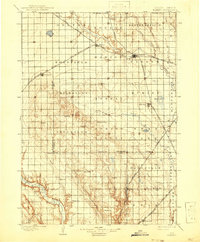
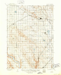
Editions of this 1898 Parker Map
4 editions found
Other maps of this area

1897 · Canton
USGS Topo · 1:125,000

1898 · Olivet
USGS Topo · 1:125,000

1898 · Parker
USGS Topo · 1:125,000

1898 · Elk Point
USGS Topo · 1:125,000

1899 · Alexandria
USGS Topo · 1:125,000

1900 · Canton
USGS Topo · 1:125,000

1901 · Elk Point
USGS Topo · 1:125,000

1907 · Elk Point
USGS Topo · 1:125,000

1955 · Sioux City
USGS Topo · 1:250,000

1955 · Sioux Falls
USGS Topo · 1:250,000