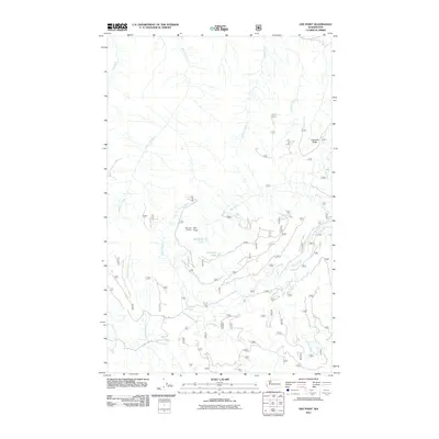
2011 Map of Gee Point
USGS Topo · Published 2011About this map
Gee Point Lookout stands as a prominent vantage over a landscape defined by an intricate network of drainage systems and forest access routes. This 2011 survey details the upper reaches of the Skagit River watershed, where Finney Creek and Pressentin Creek carve deep valleys through the high terrain. The map captures the specialized topography of Leonards Ridge and the localized basins of Gee Point Lake and Little Gee Lake. A dense web of forest service roads, including Nfd 17 Rd and Nfd 1745 Rd, reveals the infrastructure required to manage these timbered uplands. The distribution of waterways like Hatchery Creek and Chute Creek suggests a terrain shaped by heavy precipitation and runoff, providing a clear record of the area's hydrology before later environmental shifts or management changes.
Find a feature on this map
18 named features on this map. Tap any name to fly to it.
Don’t see what you’re looking for? This feature index may not catch every label — zoom into the map to look around manually.
Map Details
Editions of this 2011 Gee Point Map
This is the sole edition of this map. No revisions or reprints were ever made.
Other maps of this area

1899 · Stillaguamish
USGS Topo · 1:125,000

1901 · Stilaguamish
USGS Topo · 1:125,000

1909 · Mt Baker
USGS Topo · 1:192,000

1915 · Mt. Baker
USGS Topo · 1:250,000

1952 · Lake Shannon
USGS Topo · 1:62,500

1952 · Hamilton
USGS Topo · 1:62,500

1955 · Concrete
USGS Topo · 1:250,000

1956 · Oso
USGS Topo · 1:62,500

1958 · Concrete
USGS Topo · 1:250,000

1962 · Concrete
USGS Topo · 1:250,000