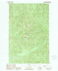
1989 Map of Gee Point
USGS Topo · Published 1989About this map
Mt Baker National Forest encompasses the high-altitude terrain of this Skagit County landscape, centered on the prominent summit of Gee Point. The area is defined by a dense network of mountain drainages, where Finney Creek and its various tributaries, such as Chute Creek and DeForest Creek, carve through the steep topography. Small glacial features are visible near the peaks, including the secluded Gee Point Lake and Little Gee Lake.
Find a feature on this map
18 named features on this map. Tap any name to fly to it.
Don’t see what you’re looking for? This feature index may not catch every label — zoom into the map to look around manually.
Map Details
Editions of this 1989 Gee Point Map
This is the sole edition of this map. No revisions or reprints were ever made.
Other maps of this area

1899 · Stillaguamish
USGS Topo · 1:125,000

1901 · Stilaguamish
USGS Topo · 1:125,000

1909 · Mt Baker
USGS Topo · 1:192,000

1915 · Mt. Baker
USGS Topo · 1:250,000

1952 · Lake Shannon
USGS Topo · 1:62,500

1952 · Hamilton
USGS Topo · 1:62,500

1955 · Concrete
USGS Topo · 1:250,000

1956 · Oso
USGS Topo · 1:62,500

1958 · Concrete
USGS Topo · 1:250,000

1962 · Concrete
USGS Topo · 1:250,000