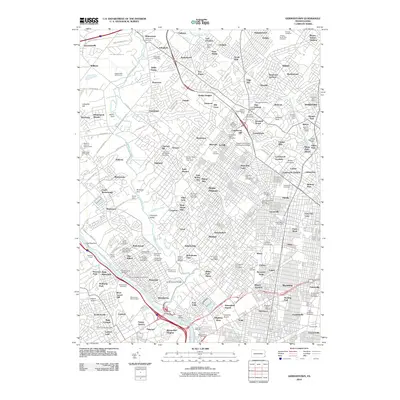
2010 Map of Germantown
USGS Topo · Published 2010About this map
Wissahickon Creek carves through the heart of this landscape, joining the Schuylkill River near the industrial and residential clusters of Manayunk and Wissahickon. The map reveals a densely developed urban and suburban corridor characterized by an extensive network of cemeteries and educational institutions. Large memorial grounds like West Laurel Hill Cemetery, Ivy Hill Cemetery, and the National Cemetery occupy significant acreage, serving as quiet landmarks amidst the bustling neighborhoods of Germantown and Mount Pleasant.
Find a feature on this map
198 named features on this map. Tap any name to fly to it.
Don’t see what you’re looking for? This feature index may not catch every label — zoom into the map to look around manually.
Map Details
Editions of this 2010 Germantown Map
This is the sole edition of this map. No revisions or reprints were ever made.
Other maps of this area

1891 · Philadelphia
USGS Topo · 1:62,500

1893 · Germantown
USGS Topo · 1:62,500

1894 · Chester
USGS Topo · 1:62,500

1894 · Philadelphia
USGS Topo · 1:62,500

1894 · Norristown
USGS Topo · 1:62,500

1894 · Germantown
USGS Topo · 1:62,500

1895 · Norristown
USGS Topo · 1:62,500

1896 · Germantown
USGS Topo · 1:62,500

1896 · Philadelphia
USGS Topo · 1:62,500

1896 · Norristown
USGS Topo · 1:62,500
Featured Places
- Philadelphia, PA
- Abington Township, PA
- Cheltenham Township, PA
- Whitemarsh Township, PA
- Glenside, Cheltenham Township