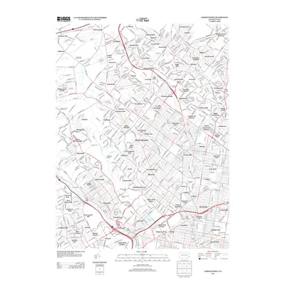
2013 Map of Germantown
USGS Topo · Published 2013About this map
The Schuylkill River and Manayunk Canal anchor the southwestern corner of this urban and suburban landscape, where the Flat Rock Tunnel and numerous bridges like the Henry Avenue Bridge and Green Lane Bridge facilitate movement across the water. The map reveals a dense network of neighborhoods, from the established streets of Glenside and Wyncote to the residential clusters of East Oreland and Sunnybrook. Water management is a prominent theme, evidenced by several large infrastructure projects including the Queen Lane Reservoir, Oak Lane Reservoir, and Belmont Reservoir.
Find a feature on this map
600 named features on this map. Tap any name to fly to it.
Don’t see what you’re looking for? This feature index may not catch every label — zoom into the map to look around manually.
Map Details
Editions of this 2013 Germantown Map
This is the sole edition of this map. No revisions or reprints were ever made.
Other maps of this area

1891 · Philadelphia
USGS Topo · 1:62,500

1893 · Germantown
USGS Topo · 1:62,500

1894 · Chester
USGS Topo · 1:62,500

1894 · Philadelphia
USGS Topo · 1:62,500

1894 · Norristown
USGS Topo · 1:62,500

1894 · Germantown
USGS Topo · 1:62,500

1895 · Norristown
USGS Topo · 1:62,500

1896 · Germantown
USGS Topo · 1:62,500

1896 · Philadelphia
USGS Topo · 1:62,500

1896 · Norristown
USGS Topo · 1:62,500
Featured Places
- Philadelphia, PA
- Abington Township, PA
- Cheltenham Township, PA
- Whitemarsh Township, PA
- Glenside, Cheltenham Township