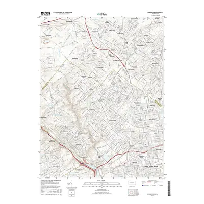
2016 Map of Germantown
USGS Topo · Published 2016About this map
Wissahickon Creek carves a deep wooded valley through the heart of this urban and suburban landscape, flanked by extensive trail networks including the Orange Trail and Forbidden Drive. This 2016 survey captures the densely layered history of northwest Philadelphia and neighboring Montgomery County, where educational institutions and vast memorial grounds dominate the greenery. Significant academic sites like Arcadia University, Westminster Theological Seminary, and the Lutheran Theological Seminary are prominent landmarks.
Find a feature on this map
385 named features on this map. Tap any name to fly to it.
Don’t see what you’re looking for? This feature index may not catch every label — zoom into the map to look around manually.
Map Details
Editions of this 2016 Germantown Map
This is the sole edition of this map. No revisions or reprints were ever made.
Other maps of this area

1891 · Philadelphia
USGS Topo · 1:62,500

1893 · Germantown
USGS Topo · 1:62,500

1894 · Chester
USGS Topo · 1:62,500

1894 · Philadelphia
USGS Topo · 1:62,500

1894 · Norristown
USGS Topo · 1:62,500

1894 · Germantown
USGS Topo · 1:62,500

1895 · Norristown
USGS Topo · 1:62,500

1896 · Germantown
USGS Topo · 1:62,500

1896 · Philadelphia
USGS Topo · 1:62,500

1896 · Norristown
USGS Topo · 1:62,500
Featured Places
- Philadelphia, PA
- Abington Township, PA
- Cheltenham Township, PA
- Whitemarsh Township, PA
- Glenside, Cheltenham Township