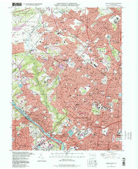
1997 Map of Germantown
USGS Topo · Published 1998About this map
The Wissahickon Creek valley forms a deep green corridor through the dense residential and industrial fabric of Northwest Philadelphia. This landscape is defined by the transition from the historic stone architecture of Germantown and Chestnut Hill to the suburban expansions of Montgomery Co to the north. Significant institutional grounds dominate the area, including the sprawling West Laurel Hill Cemetery and the Deshler-Morris House, which connects the neighborhood to early American history.
Find a feature on this map
151 named features on this map. Tap any name to fly to it.
Don’t see what you’re looking for? This feature index may not catch every label — zoom into the map to look around manually.
Map Details
Editions of this 1997 Germantown Map
This is the sole edition of this map. No revisions or reprints were ever made.
Other maps of this area

1891 · Philadelphia
USGS Topo · 1:62,500

1893 · Germantown
USGS Topo · 1:62,500

1894 · Chester
USGS Topo · 1:62,500

1894 · Philadelphia
USGS Topo · 1:62,500

1894 · Norristown
USGS Topo · 1:62,500

1894 · Germantown
USGS Topo · 1:62,500

1895 · Norristown
USGS Topo · 1:62,500

1896 · Germantown
USGS Topo · 1:62,500

1896 · Philadelphia
USGS Topo · 1:62,500

1896 · Norristown
USGS Topo · 1:62,500
Featured Places
- Philadelphia, PA
- Abington Township, PA
- Cheltenham Township, PA
- Whitemarsh Township, PA
- Glenside, Cheltenham Township