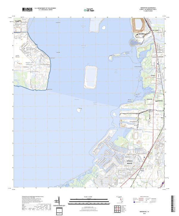
2024 Map of Gibsonton
USGS Topo · Published 2024About this map
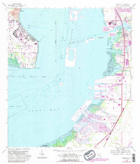
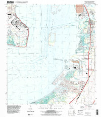
MacDill Air Force Base dominates the western shore of Hillsborough Bay, its runways and administrative facilities like Administration Ave and Constellation Blvd marking the Interbay Peninsula. Across the water to the east, the shoreline is defined by a series of tidal inlets and industrial developments. The mouth of the Alafia River serves as a focal point for maritime activity, with the Alafia River Channel providing passage past Bird Island and Sunken Island. Residential growth is evident in communities like Apollo Beach and Gibsonton, where modern street grids meet the natural drainages of Bullfrog Creek and Jackson Branch. The presence of the CSX Transportation rail line and the Industrial Access Rd in East Tampa highlights the area's role as a transportation corridor connecting the coast to the interior.
Find a feature on this map
130 named features on this map. Tap any name to fly to it.
Don’t see what you’re looking for? This feature index may not catch every label — zoom into the map to look around manually.
Map Details
Editions of this 2024 Gibsonton Map
This is the sole edition of this map. No revisions or reprints were ever made.
Historical Maps of Apollo Beach Through Time
3 maps found