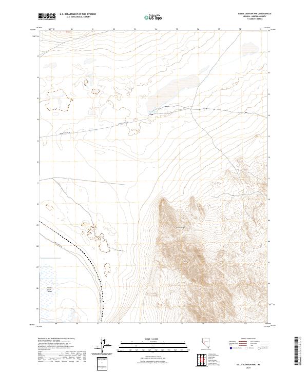
2021 Map of Gillis Canyon NW
USGS Topo · Published 2021About this map
Walker River Valley and the northern reaches of the Gillis Range define this high-desert landscape in Mineral County, Nevada. The topography is dominated by the complex terrain of the range, which rises sharply from the arid valley floor. Water, a critical resource in this environment, is marked by the presence of Double Spring, a vital focal point for local navigation and history. The map records a sparse network of pathways, including the descriptive Ghost Dance Ln and the more established Double Springs Rd, which snakes across the flats at the foot of the mountains. This 2021 survey reveals a landscape largely shaped by natural boundaries and the legacy of early desert routes, where open space and geological features dictate the pattern of human presence.
Find a feature on this map
9 named features on this map. Tap any name to fly to it.
Don’t see what you’re looking for? This feature index may not catch every label — zoom into the map to look around manually.
Map Details
Editions of this 2021 Gillis Canyon NW Map
This is the sole edition of this map. No revisions or reprints were ever made.
Other maps of this area

1908 · Carson Sink
USGS Topo · 1:250,000

1909 · Hawthorne
USGS Topo · 1:250,000

1910 · Carson Sink
USGS Topo · 1:250,000

1911 · Hawthorne
USGS Topo · 1:250,000

1915 · Hawthorne
USGS Topo · 1:250,000

1948 · Walker Lake
USGS Topo · 1:250,000

1951 · Allen Springs
USGS Topo · 1:62,500

1951 · Weber Reservoir
USGS Topo · 1:62,500

1957 · Walker Lake
USGS Topo · 1:250,000

1957 · Reno
USGS Topo · 1:250,000