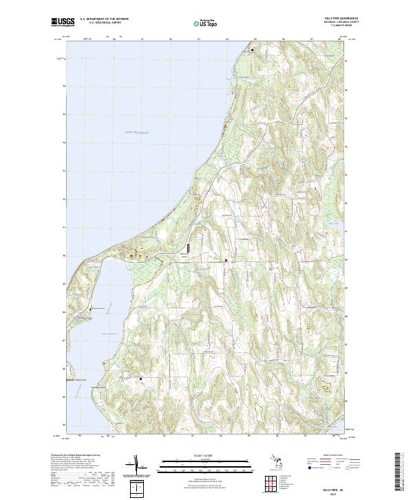
2023 Map of Gills Pier
USGS Topo · Published 2023About this map
The coastal village of Leland sits on a narrow strip of land between the expansive waters of Lake Michigan and the northern reaches of Lake Leelanau. This landscape in the northwestern portion of Michigan’s Leelanau Peninsula is defined by its deep connection to the water, featuring prominent landforms like Cemetery Point and Wardens Point. The interior reveals a history of spiritual and community centers, documented through several burial grounds including the Onominese Indian Cem and the Saint Wenceslaus Cem. Transport and infrastructure are represented by the presence of the Dune Bird Airport near E Kolarik Rd, while the hydrography is characterized by numerous small streams such as Roaring Brook and Gills Creek that drain toward the coastline. This 2023 survey provides a modern record of the area’s traditional township boundaries and its enduring lakeside settlement patterns.
Find a feature on this map
83 named features on this map. Tap any name to fly to it.
Don’t see what you’re looking for? This feature index may not catch every label — zoom into the map to look around manually.
Map Details
Editions of this 2023 Gills Pier Map
This is the sole edition of this map. No revisions or reprints were ever made.
Other maps of this area

1954 · Traverse City
USGS Topo · 1:250,000

1955 · Cheboygan
USGS Topo · 1:250,000

1957 · Traverse City
USGS Topo · 1:62,500

1957 · Northport
USGS Topo · 1:62,500

1957 · Maple City
USGS Topo · 1:62,500

1958 · Cheboygan
USGS Topo · 1:250,000

1958 · Traverse City
USGS Topo · 1:250,000

1983 · Northport
USGS Topo · 1:25,000

1983 · Omena
USGS Topo · 1:24,000
1983 · Northport NW
USGS Topo · 1:25,000