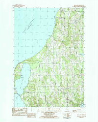
1983 Map of Gills Pier
USGS Topo · Published 1984About this map
Lake Michigan dominates the western shoreline of this Leelanau County survey, where the small settlement of Gills Pier sits at the mouth of Gills Creek. The landscape transitions from the sandy bluffs and points of the coast, including Cemetery Point and Wardens Point, to a rolling interior defined by family-named roads and scattered social hubs. Cultural sites are prominent, featuring the St Wenceslaus Ch and the Indian Mission Ch, alongside several community burial grounds like Omonomene Cem and Beechwood Cem.
Find a feature on this map
44 named features on this map. Tap any name to fly to it.
Don’t see what you’re looking for? This feature index may not catch every label — zoom into the map to look around manually.
Map Details
Editions of this 1983 Gills Pier Map
This is the sole edition of this map. No revisions or reprints were ever made.
Other maps of this area

1954 · Traverse City
USGS Topo · 1:250,000

1955 · Cheboygan
USGS Topo · 1:250,000

1957 · Traverse City
USGS Topo · 1:62,500

1957 · Northport
USGS Topo · 1:62,500

1957 · Maple City
USGS Topo · 1:62,500

1958 · Cheboygan
USGS Topo · 1:250,000

1958 · Traverse City
USGS Topo · 1:250,000

1983 · Northport
USGS Topo · 1:25,000

1983 · Omena
USGS Topo · 1:24,000
1983 · Northport NW
USGS Topo · 1:25,000