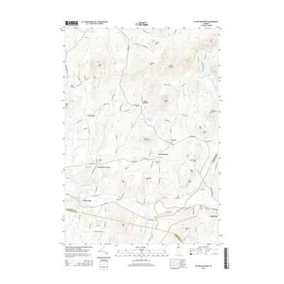
2015 Map of Gilson Mountain
USGS Topo · Published 2015About this map
Gilson Mountain rises as the central height in this Vermont landscape, where the northern foothills of the Green Mountains meet the drainage of the Lamoille River. The terrain is characterized by numerous family-named peaks and ridges, including Cobbler Hill, Coombs Hill, and Leach Hill, reflecting a long history of upland farming and land use. Small settlements such as Binghamville, West Fletcher, and Sanderson Corner serve as local anchors, connected by a network of rural roads like Fairfield Rd and Cambridge Rd.
Find a feature on this map
111 named features on this map. Tap any name to fly to it.
Don’t see what you’re looking for? This feature index may not catch every label — zoom into the map to look around manually.
Map Details
Editions of this 2015 Gilson Mountain Map
This is the sole edition of this map. No revisions or reprints were ever made.
Other maps of this area

1913 · Milton
USGS Topo · 1:48,000

1914 · St. Albans
USGS Topo · 1:48,000

1915 · Milton
USGS Topo · 1:62,500

1916 · St. Albans
USGS Topo · 1:62,500

1920 · Franklin Pond
USGS Topo · 1:62,500

1922 · Enosburg Falls
USGS Topo · 1:48,000

1924 · Enosburg Falls
USGS Topo · 1:62,500

1925 · Mount Mansfield
USGS Topo · 1:48,000

1927 · Mount Mansfield
USGS Topo · 1:62,500

1943 · St. Albans
USGS Topo · 1:62,500