
1927 Map of Mount Mansfield
USGS Topo · Published 1927About this map
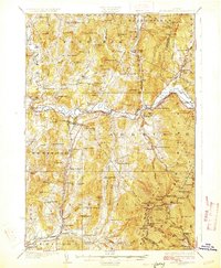
The Lamoille River valley serves as the central artery for this northern Vermont region, where the St Johnsbury and Lake Champlain Railroad meets the Central Vermont Railway at Cambridge Junction. The settlement pattern reflects a mix of valley villages like Jeffersonville and Cambridge and upland hamlets such as the Irish Settlement. Higher elevations are dominated by the ridge of the Green Mountains, featuring the Mt Mansfield Hotel and the Halfway House along the Toll Road. Small district schools, including the Smiley School and Governors Right School, are scattered throughout the townships of Fletcher, Underhill, and Cambridge, indicating the density of rural family life in the 1920s. Industrial activity is represented by Morses Mill and the power generation at Fairfax Falls on the western edge of the survey area.
Find a feature on this map
110 named features on this map. Tap any name to fly to it.
Don’t see what you’re looking for? This feature index may not catch every label — zoom into the map to look around manually.
Map Details
Editions of this 1927 Mount Mansfield Map
5 editions found
Other maps of this area

1906 · Burlington
USGS Topo · 1:62,500

1913 · Milton
USGS Topo · 1:48,000

1914 · St. Albans
USGS Topo · 1:48,000

1915 · Milton
USGS Topo · 1:62,500

1916 · St. Albans
USGS Topo · 1:62,500

1919 · Burlington
USGS Topo · 1:62,500

1919 · Montgomery
USGS Topo · 1:62,500

1919 · Montpelier
USGS Topo · 1:62,500

1920 · Franklin Pond
USGS Topo · 1:62,500

1920 · Montgomery
USGS Topo · 1:62,500