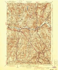
1927 Map of Mount Mansfield
USGS Topo · Published 1940About this map
The Central Vermont railroad winds through the river valleys and mountain passes of the Green Mountains in this late 1920s survey. Higher elevations are dominated by the ridge of Mount Mansfield, where landmarks like the Mt Mansfield Hotel and Taft Lodge serve early twentieth-century mountain travelers near Madonna Peak. The map documents a rural landscape shaped by localized mountain communities, including the Irish Settlement School and English Settlement School in Underhill, which reflect the distinct ethnic pockets that defined the area's social geography.
Find a feature on this map
112 named features on this map. Tap any name to fly to it.
Don’t see what you’re looking for? This feature index may not catch every label — zoom into the map to look around manually.
Map Details
Editions of this 1927 Mount Mansfield Map
5 editions found

Other maps of this area

1906 · Burlington
USGS Topo · 1:62,500

1913 · Milton
USGS Topo · 1:48,000

1914 · St. Albans
USGS Topo · 1:48,000

1915 · Milton
USGS Topo · 1:62,500

1916 · St. Albans
USGS Topo · 1:62,500

1919 · Burlington
USGS Topo · 1:62,500

1919 · Montgomery
USGS Topo · 1:62,500

1919 · Montpelier
USGS Topo · 1:62,500

1920 · Franklin Pond
USGS Topo · 1:62,500

1920 · Montgomery
USGS Topo · 1:62,500