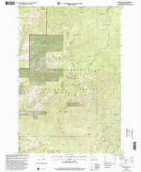
1998 Map of Gird Point
USGS Topo · Published 2002About this map
The Darby Ranger District of the Bitterroot National Forest dominates this topographic study of the Montana backcountry. The landscape is defined by its network of steep drainages, including Tenderfoot Gulch, Coffee Gulch, and Newton Gulch, which feed into larger watercourses like Skalkaho Creek. The map documents a geography built around forest management and public recreation, centering on features like the Black Bear Campground and the Centennial Nature Grove. Elevation is the primary driver of navigation here, with summits like Gird Point and the high pass at Buck Horn Saddle serving as key landmarks. Subtle details for the local historian include the Gaging Station on Skalkaho Creek and various seasonal camps like Yellowstone Camp. The presence of Railroad Creek and Daly Creek further illustrates the complex drainage system of the Ravalli County wilderness during the late 1990s.
Find a feature on this map
34 named features on this map. Tap any name to fly to it.
Don’t see what you’re looking for? This feature index may not catch every label — zoom into the map to look around manually.
Map Details
Editions of this 1998 Gird Point Map
This is the sole edition of this map. No revisions or reprints were ever made.
Other maps of this area

1901 · Hamilton
USGS Topo · 1:125,000

1909 · Sapphire
USGS Topo · 1:125,000

1947 · Butte
USGS Topo · 1:250,000

1956 · Hamilton
USGS Topo · 1:250,000

1958 · Butte
USGS Topo · 1:250,000

1959 · Hamilton
USGS Topo · 1:250,000

1960 · Butte
USGS Topo · 1:250,000

1960 · Hamilton
USGS Topo · 1:250,000

1962 · Butte
USGS Topo · 1:250,000

1964 · Hamilton
USGS Topo · 1:250,000