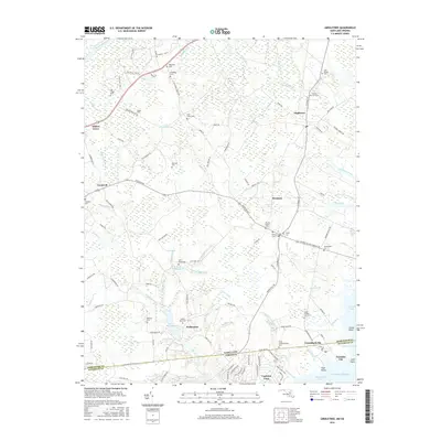
2016 Map of Girdletree
USGS Topo · Published 2016About this map
The Maryland Virginia state line cuts through this coastal landscape, where the tidal influence of the Atlantic Ocean meets the inland wetlands of the Eastern Shore. The Pocomoke River defines the northwest corner, while the southeastern corner reveals the marshy transition into Purnell Bay and Chincoteague Bay. This 2016 survey documents a dense concentration of lineage-rich sites, from the coastal development at Captains Cove to the scattered settlements of Girdletree, Stockton, and Greenbackville. The terrain is characterized by a complex network of drainage features like Jones Ditch and Marshall Ditch, supporting several historical water-control points such as Little Millpond and Big Millpond. Genealogists will find extensive graveyard records including Saint Lukes Cem, Old Shiloh Cem, and Union Greenbackville Cem, which are interspersed among named family tracts like Tarr Tract-Part 2.
Find a feature on this map
123 named features on this map. Tap any name to fly to it.
Don’t see what you’re looking for? This feature index may not catch every label — zoom into the map to look around manually.
Map Details
Editions of this 2016 Girdletree Map
This is the sole edition of this map. No revisions or reprints were ever made.
Other maps of this area

1901 · Snow Hill
USGS Topo · 1:62,500

1942 · Chincoteague East
USGS Topo · 1:24,000

1942 · Snow Hill
USGS Topo · 1:24,000

1942 · Wesley
USGS Topo · 1:24,000

1942 · Dividing Creek
USGS Topo · 1:24,000

1943 · Snow Hill
USGS Topo · 1:31,680

1943 · Boxiron
USGS Topo · 1:31,680

1943 · Dividing Creek
USGS Topo · 1:31,680
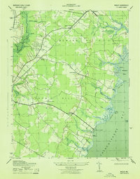
1943 · Wesley
USGS Topo · 1:31,680

1943 · Chincoteague West
USGS Topo · 1:31,680