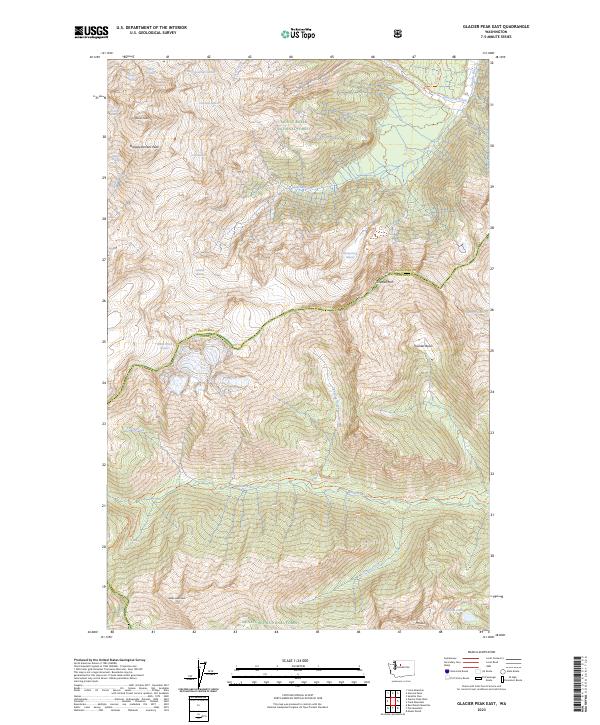
2023 Map of Glacier Peak East
USGS Topo · Published 2023About this map
Glacier Peak dominates this high-altitude landscape along the border of Snohomish and Chelan Counties, surrounded by an intricate network of ice fields and volcanic features. This recent survey documents the massive glacial systems flowing from the peak, including Chocolate Glacier to the northeast and the Cool Glacier and Suiattle Glacier to the south. The rugged topography is divided between the Mount Baker National Forest and the Wenatchee National Forest, with a significant portion protected within the Glacier Peak Wilderness. Notable summits like Tenpeak Mtn and Disappointment Peak anchor the surrounding ridges. Remote access is recorded via the Suiattle River Trl and White River Trl, which follow the deep river valleys that drain the melting snowpack toward Airplane Lake and the Suiattle River.
Find a feature on this map
38 named features on this map. Tap any name to fly to it.
Don’t see what you’re looking for? This feature index may not catch every label — zoom into the map to look around manually.
Map Details
Editions of this 2023 Glacier Peak East Map
This is the sole edition of this map. No revisions or reprints were ever made.
Other maps of this area

1899 · Glacier Peak
USGS Topo · 1:125,000

1901 · Glacier Peak
USGS Topo · 1:125,000

1901 · Chiwaukum
USGS Topo · 1:125,000

1902 · Skykomish
USGS Topo · 1:125,000

1902 · Stehekin
USGS Topo · 1:125,000

1904 · Stehekin
USGS Topo · 1:125,000

1904 · Chiwaukum
USGS Topo · 1:125,000

1905 · Skykomish
USGS Topo · 1:125,000

1944 · Holden
USGS Topo · 1:62,500

1949 · Holden
USGS Topo · 1:62,500