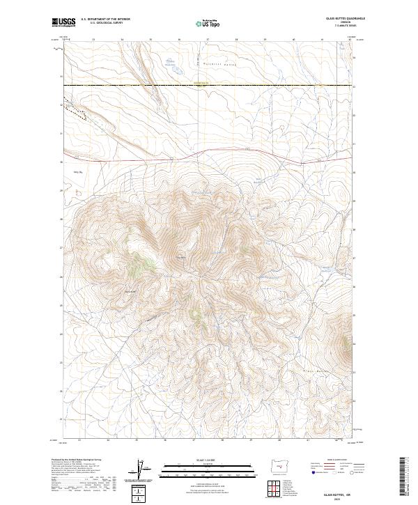
2023 Map of Glass Buttes
USGS Topo · Published 2023About this map
Glass Butte and Buck Butte dominate this high-desert landscape in central Oregon, where the border between Deschutes and Lake counties cuts through the Gilchrist Valley. The map reveals a land defined by water management and natural springs, essential for ranching and wildlife in this arid environment. Named water sources such as Chesebro Spring, Cabin Spring, and Dribble Spring are scattered across the slopes, while man-made improvements like Swale Reservoir, Question Reservoir, and Musser Reservoir show the infrastructure of the range. The terrain transitions from the open expanse of Perry Flat in the northwest to the complex volcanic topography of the Glass Buttes range, with drainage through features like Musser Draw. Buck Creek Rd provides the primary access through the northern valley floor.
Find a feature on this map
20 named features on this map. Tap any name to fly to it.
Don’t see what you’re looking for? This feature index may not catch every label — zoom into the map to look around manually.
Map Details
Editions of this 2023 Glass Buttes Map
This is the sole edition of this map. No revisions or reprints were ever made.
Other maps of this area

1955 · Crescent
USGS Topo · 1:250,000

1955 · Burns
USGS Topo · 1:250,000

1957 · Crescent
USGS Topo · 1:250,000

1958 · Crescent
USGS Topo · 1:250,000

1958 · Burns
USGS Topo · 1:250,000

1959 · Burns
USGS Topo · 1:250,000

1970 · Crescent
USGS Topo · 1:250,000

1980 · Round Top Butte
USGS Topo · 1:24,000

1981 · Hat Butte
USGS Topo · 1:24,000
1981 · Tired Horse Butte
USGS Topo · 1:24,000