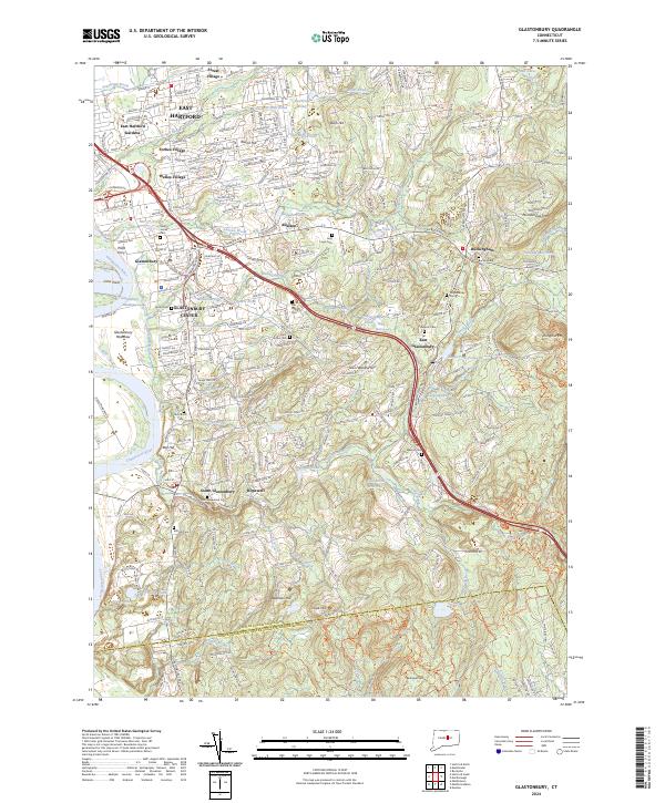
2024 Map of Glastonbury
USGS Topo · Published 2024About this map
Glastonbury Center and the eastern banks of the Connecticut River anchor this detailed study of the region's modern settlement patterns. From the densely populated neighborhoods of Welles Village and East Hartford Gardens in the north to the more agrarian character of South Glastonbury, the map highlights the area's transition from riverfront commerce to suburban and woodland landscapes. Historical burial sites such as Buckingham Cem and Old Eastbury Cem are scattered across the terrain, serving as vital touchstones for genealogical research in this part of Hartford County. The landscape is defined by its water systems, including the notable Shoddy Mill Pond and the extensive Glastonbury Meadows along the river. These features, alongside named peaks like Minnechaug Mtn and Kongscut Mtn, illustrate the varied topography that has shaped the community's development from its earliest colonial roots to its contemporary layout.
Find a feature on this map
83 named features on this map. Tap any name to fly to it.
Don’t see what you’re looking for? This feature index may not catch every label — zoom into the map to look around manually.
Map Details
Editions of this 2024 Glastonbury Map
This is the sole edition of this map. No revisions or reprints were ever made.
Other maps of this area

1892 · Hartford
USGS Topo · 1:62,500

1892 · Tolland
USGS Topo · 1:62,500

1892 · Gilead
USGS Topo · 1:62,500

1893 · Middletown
USGS Topo · 1:62,500

1906 · Farmington
USGS Topo · 1:125,000

1921 · Tolland
USGS Topo · 1:62,500

1928 · Cromwell
USGS Topo · 1:24,000

1928 · Windsor
USGS Topo · 1:24,000

1928 · Glastonbury
USGS Topo · 1:24,000

1928 · Manchester
USGS Topo · 1:24,000