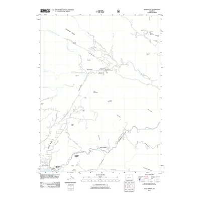
2011 Map of Glen Haven
USGS Topo · Published 2011About this map
Glen Haven sits at the confluence of several mountain drainages, including the North Fork Big Thompson River and West Creek. This 2011 survey illustrates the complex human footprint in the high country, where working cattle operations like McGraw Ranch and H Bar G Ranch share the landscape with modern residential pockets such as Olympus Heights and Loveland Heights. The map traces a history of resource extraction and infrastructure, from the Lewis Beryl Mine and Hideabove Mine on Storm Mountain to the hydraulic engineering of the Olympus Tunnel and Pole Hill Tunnel. The steep, narrow passage of Big Thompson Canyon remains a dominant physical feature, dictating the placement of roads and settlements along the river's path toward Lake Estes. Recreation is well established here, evidenced by the Dunraven Trailhead and several picnic grounds along the Miller Fork.
Find a feature on this map
72 named features on this map. Tap any name to fly to it.
Don’t see what you’re looking for? This feature index may not catch every label — zoom into the map to look around manually.
Map Details
Editions of this 2011 Glen Haven Map
This is the sole edition of this map. No revisions or reprints were ever made.
Other maps of this area

1905 · Mount Olympus
USGS Topo · 1:62,500

1907 · Mount Olympus
USGS Topo · 1:62,500

1907 · Livermore
USGS Topo · 1:125,000

1909 · Livermore
USGS Topo · 1:125,000

1915 · Longs Peak
USGS Topo · 1:125,000

1916 · Home
USGS Topo · 1:125,000

1919 · Rocky Mountain National Park
USGS Topo · 1:125,000

1920 · Home
USGS Topo · 1:125,000

1954 · Greeley
USGS Topo · 1:250,000

1957 · Greeley
USGS Topo · 1:250,000