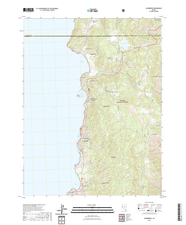
2021 Map of Glenbrook
USGS Topo · Published 2021About this map
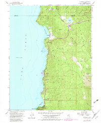
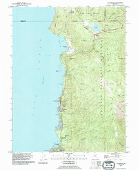
The eastern shore of Lake Tahoe is defined here by the rising slopes of the Carson Range, where steep canyons like Slaughterhouse Canyon and Montreal Canyon descend toward the water. This 2021 survey of the Douglas County coastline captures a string of residential enclaves and historic landing sites, from the established community of Glenbrook near China Gardens down to the residential clusters of Lincoln Park and Lakeridge. The geography is shaped by prominent granite landmarks such as Shakespeare Point and the towering Cave Rock, which stands as a sentinel over the shoreline highway.
Find a feature on this map
53 named features on this map. Tap any name to fly to it.
Don’t see what you’re looking for? This feature index may not catch every label — zoom into the map to look around manually.
Map Details
Editions of this 2021 Glenbrook Map
This is the sole edition of this map. No revisions or reprints were ever made.
Historical Maps of Zephyr Cove Through Time
3 maps found