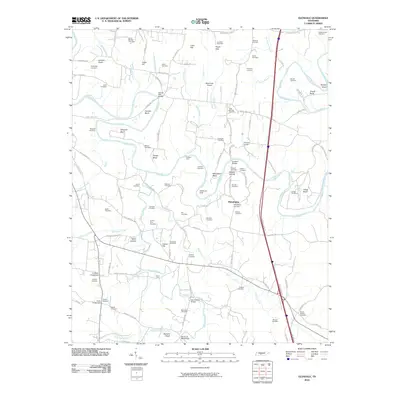
2010 Map of Glendale
USGS Topo · Published 2010About this map
The Duck River winds through this Maury County landscape, its course defined by prominent bends like Cannon Bend and Vaughan Bend. This area of Middle Tennessee is characterized by a dense network of family-named landmarks and rural settlements, including Philadelphia and Harris Crossroads. The map reveals an intricate historical footprint through dozens of small burial grounds, such as the Pleasant Mount Cemetery and the Dillehay Cemetery, which serve as vital markers for local genealogical research.
Find a feature on this map
113 named features on this map. Tap any name to fly to it.
Don’t see what you’re looking for? This feature index may not catch every label — zoom into the map to look around manually.
Map Details
Editions of this 2010 Glendale Map
This is the sole edition of this map. No revisions or reprints were ever made.
Other maps of this area

1901 · Colombia
USGS Topo · 1:125,000

1936 · Godwin
USGS Topo · 1:24,000

1936 · Lewisburg
USGS Topo · 1:24,000

1936 · Verona
USGS Topo · 1:24,000

1936 · Campbells Station
USGS Topo · 1:24,000

1936 · Rally Hill
USGS Topo · 1:24,000

1936 · Carters Creek
USGS Topo · 1:24,000

1936 · Glendale
USGS Topo · 1:24,000

1936 · Columbia
USGS Topo · 1:24,000

1936 · Lynnville
USGS Topo · 1:24,000