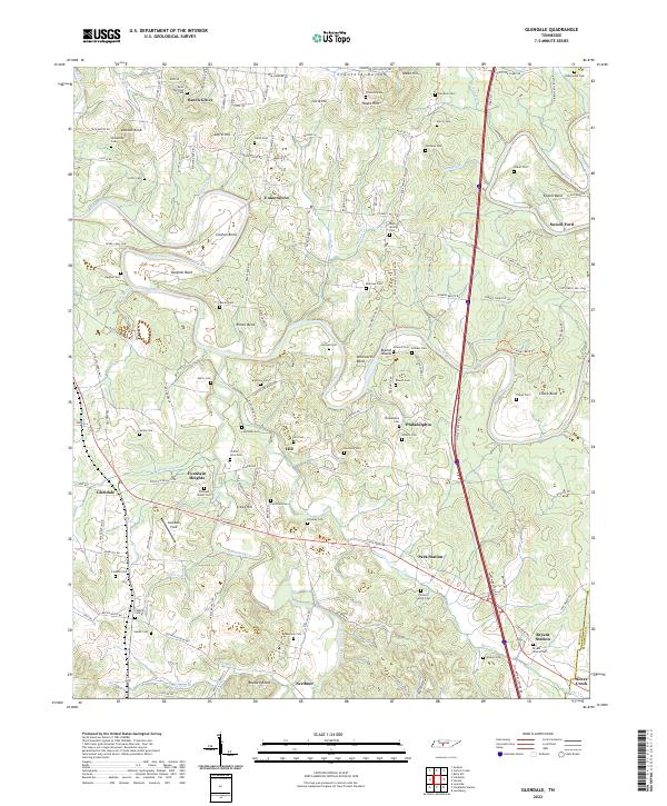
2022 Map of Glendale
USGS Topo · Published 2022About this map
Duck River serpentines across this landscape, creating dramatic bends such as Cheek Bend, Whitworth Bend, and Rieves Bend. These deep river loops dictated early settlement patterns, leaving upland ridges for communities like Beech Grove and Union Grove. The area is notably dense with small family and community burial grounds, including Puckett Family Cem, Davis Mitchell Cem, and Tankersley Cem, which offer significant value for genealogists tracing Maury County roots. Transport corridors are defined by the convergence of water and rail, with Park Station and Bryant Station situated near the Silver Cr drainage. Along Fountain Creek, the small hub of Glendale sits near Glendale Field, illustrating the transition from traditional river crossings like Sowell Ford to modern infrastructure that skirts the edges of the Maury Co and Marshall Co line.
Find a feature on this map
140 named features on this map. Tap any name to fly to it.
Don’t see what you’re looking for? This feature index may not catch every label — zoom into the map to look around manually.
Map Details
Editions of this 2022 Glendale Map
This is the sole edition of this map. No revisions or reprints were ever made.
Other maps of this area

1901 · Colombia
USGS Topo · 1:125,000

1936 · Godwin
USGS Topo · 1:24,000

1936 · Lewisburg
USGS Topo · 1:24,000

1936 · Verona
USGS Topo · 1:24,000

1936 · Campbells Station
USGS Topo · 1:24,000

1936 · Rally Hill
USGS Topo · 1:24,000

1936 · Carters Creek
USGS Topo · 1:24,000

1936 · Glendale
USGS Topo · 1:24,000

1936 · Columbia
USGS Topo · 1:24,000

1936 · Lynnville
USGS Topo · 1:24,000