
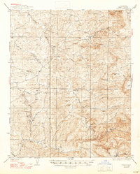
1926 Map of Glennville
USGS Topo · Published 1926About this map
Sequoia National Forest lands dominate this 1920s tactical survey, showing a landscape defined by remote ranger stations and early mountain infrastructure. The settlement of Havilah sits in the southeast, once a bustling mining center, while Glennville anchor the northwest corner. A network of early government outposts, including Davis RS, Caillands RS, and Mill Creek RS, indicates the systematic management of the timber and water resources during this era.
Find a feature on this map
50 named features on this map. Tap any name to fly to it.
Don’t see what you’re looking for? This feature index may not catch every label — zoom into the map to look around manually.
Map Details
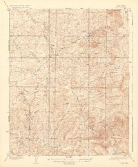
Editions of this 1926 Glennville Map
This is the sole edition of this map. No revisions or reprints were ever made.
Other maps of this area

1906 · Kernville
USGS Topo · 1:125,000

1908 · Kernville
USGS Topo · 1:125,000

1914 · Caliente
USGS Topo · 1:125,000

1915 · Mojave
USGS Topo · 1:125,000

1920 · Delonagha
USGS Topo · 1:62,500
1932 · Woody
USGS Topo · 1:62,500
1935 · Woody
USGS Topo · 1:62,500
1936 · White River
USGS Topo · 1:62,500

1936 · Tobias Peak
USGS Topo · 1:125,000
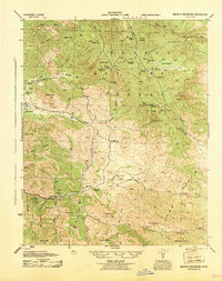
1943 · Emerald Mtn
USGS Topo · 1:62,500