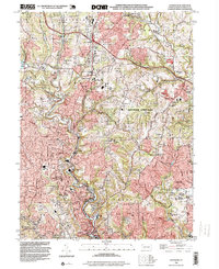
1993 Map of Glenshaw
USGS Topo · Published 1999About this map
Pine Creek carves a deep valley through the northern suburbs of Pittsburgh, anchoring a corridor of industrial and residential development during the 1990s. The landscape is defined by the winding course of the Pennsylvania RR and the Pennsylvania Turnpike, which intersect near the historic cluster of Wildwood. This era shows the suburban maturation of Glenshaw and Etna, where dense residential blocks give way to steep, wooded ridges like Cedar Ridge.
Find a feature on this map
79 named features on this map. Tap any name to fly to it.
Don’t see what you’re looking for? This feature index may not catch every label — zoom into the map to look around manually.
Map Details
Editions of this 1993 Glenshaw Map
This is the sole edition of this map. No revisions or reprints were ever made.
Other maps of this area

1904 · Mc Keesport
USGS Topo · 1:62,500

1904 · Carnegie
USGS Topo · 1:62,500

1906 · Carnegie
USGS Topo · 1:62,500

1906 · Sewickley
USGS Topo · 1:62,500

1907 · Pittsburg
USGS Topo · 1:62,500

1908 · Sewickley
USGS Topo · 1:62,500

1908 · Carnegie
USGS Topo · 1:62,500

1908 · New Kensington
USGS Topo · 1:62,500

1910 · New Kensington
USGS Topo · 1:62,500

1948 · Pittsburgh West
USGS Topo · 1:24,000