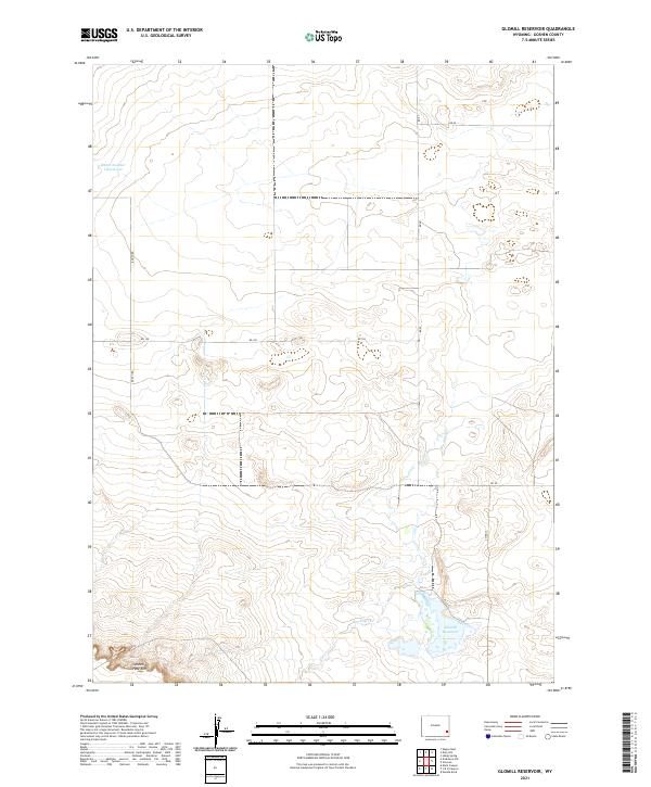
2021 Map of Glomill Reservoir
USGS Topo · Published 2021About this map
Glomill Reservoir and its surrounding high-plains landscape are the focal point of this modern survey of Goshen County. The terrain is defined by the sharp topography of the Goshen Hole Rim in the southwest corner, a notable escarpment that drops away into the lower plains. A sparse network of rural routes, including Booth Rd and Rd 128, connects isolated agricultural sections across the high country. Small water features like Baker Number 1-Reservoir and the ephemeral course of Box Elder Cr highlight the critical role of water management in this arid stretch of Wyoming. This map documents the precise section lines and drainage patterns of a working cattle and farming landscape in the early twenty-first century.
Find a feature on this map
15 named features on this map. Tap any name to fly to it.
Don’t see what you’re looking for? This feature index may not catch every label — zoom into the map to look around manually.
Map Details
Editions of this 2021 Glomill Reservoir Map
This is the sole edition of this map. No revisions or reprints were ever made.
Other maps of this area

1896 · Patrick
USGS Topo · 1:125,000

1896 · Hartville
USGS Topo · 1:125,000

1899 · Goshen Hole
USGS Topo · 1:125,000

1901 · Hartville
USGS Topo · 1:125,000

1950 · Rockeagle
USGS Topo · 1:24,000

1951 · Eagles Nest
USGS Topo · 1:24,000

1954 · Torrington
USGS Topo · 1:250,000

1954 · Cheyenne
USGS Topo · 1:250,000

1958 · Cheyenne
USGS Topo · 1:250,000

1958 · Torrington
USGS Topo · 1:250,000