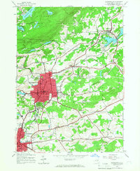
1970 Map of Gloversville
USGS Topo · Published 1972About this map
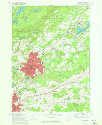
Gloversville and Johnstown anchor this survey, showing the industrial and civic core of Fulton County at the start of the 1970s. The dense urban grid of Gloversville is detailed with neighborhood landmarks like McNab Sch and Estee Jr High Sch, while the F J & G RR corridor threads through the city toward Broadalbin Junction. To the south, Johnstown displays its institutional character with the County Bldg and numerous parochial sites including St Anthonys Ch and St Patricks Sch.
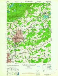
Find a feature on this map
89 named features on this map. Tap any name to fly to it.
Don’t see what you’re looking for? This feature index may not catch every label — zoom into the map to look around manually.
Map Details
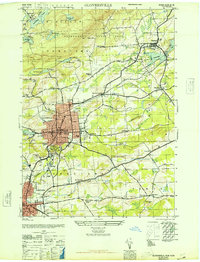
Editions of this 1970 Gloversville Map
This is the sole edition of this map. No revisions or reprints were ever made.
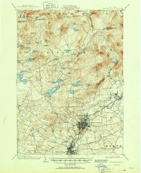
Historical Maps of Johnstown Through Time
8 maps found