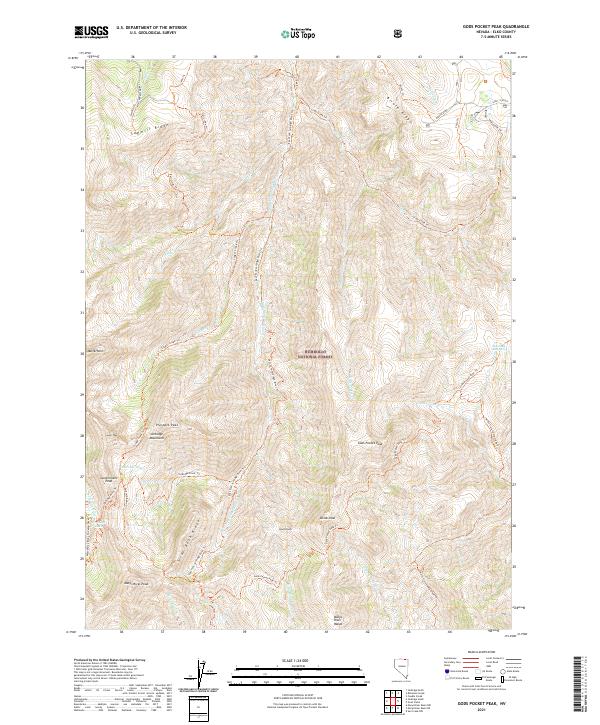
2021 Map of Gods Pocket Peak
USGS Topo · Published 2021About this map
Humboldt National Forest dominates this high-altitude landscape in the Jarbidge Mountains, where steep ridgelines like Biroth Ridge and Sawmill Ridge separate narrow canyon drainages. At the southern edge of the sheet, the Marys River Range rises to prominence at Marys River Peak, marking the headwaters of the Marys River. A network of historic foot trails, such as the East Fork Jarbidge River Trl and Emerald Basin Trl, provides the primary access through this roadless backcountry. High alpine basins hold significant water features like Emerald Lake and Jarbidge Lake beneath the shadows of Government Peak and Matterhorn. The map records a wilderness economy defined by preservation and recreation, where topographic landmarks like Gold Knob and Divide Peak serve as primary navigational waypoints.
Find a feature on this map
42 named features on this map. Tap any name to fly to it.
Don’t see what you’re looking for? This feature index may not catch every label — zoom into the map to look around manually.
Map Details
Editions of this 2021 Gods Pocket Peak Map
This is the sole edition of this map. No revisions or reprints were ever made.
Other maps of this area

1943 · Jarbidge
USGS Topo · 1:62,500

1945 · Jarbidge
USGS Topo · 1:62,500

1955 · Wells
USGS Topo · 1:250,000

1957 · Elk Mountain
USGS Topo · 1:62,500

1958 · Wells
USGS Topo · 1:250,000

1961 · Wells
USGS Topo · 1:250,000

1968 · Marys River Basin NE
USGS Topo · 1:24,000
1968 · Marys River Basin NW
USGS Topo · 1:24,000
1970 · Sun Creek NW
USGS Topo · 1:24,000
1981 · Jarbidge Mts
USGS Topo · 1:100,000