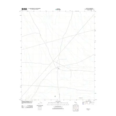
2012 Map of Goffs
USGS Topo · Published 2012About this map
Goffs serves as the central focal point of this Mojave Desert landscape, situated at a critical junction of historical travel routes in San Bernardino County. In this early twenty-first-century survey, the settlement is positioned along Goffs Rd and Lanfair Rd, illustrating its enduring role as a desert crossroads. The surrounding terrain is defined by the prominent Goffs Butte to the south and the rising slopes of the Piute Mountains to the southeast. These natural landmarks, coupled with the straight-line paths of Mountain Springs Rd, reveal a landscape shaped by both the isolation of the high desert and the infrastructure required to traverse it. The map captures the spare but deliberate settlement pattern of the region, where water sources and transit corridors dictate the placement of human activity.
Find a feature on this map
6 named features on this map. Tap any name to fly to it.
Don’t see what you’re looking for? This feature index may not catch every label — zoom into the map to look around manually.
Map Details
Editions of this 2012 Goffs Map
This is the sole edition of this map. No revisions or reprints were ever made.
Other maps of this area

1886 · Camp Mohave
USGS Topo · 1:250,000

1892 · Camp Mohave
USGS Topo · 1:250,000

1910 · Ivanpah
USGS Topo · 1:250,000

1912 · Ivanpah
USGS Topo · 1:250,000

1926 · Mohave City
USGS Topo · 1:96,000

1942 · Camp Mohave
USGS Topo · 1:250,000

1942 · Ivanpah
USGS Topo · 1:250,000

1942 · Amboy
USGS Topo · 1:250,000

1943 · Amboy
USGS Topo · 1:250,000

1943 · Fenner
USGS Topo · 1:62,500