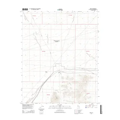
2015 Map of Goffs
USGS Topo · Published 2015About this map
Goffs stands as a focal point in this high-desert landscape, positioned at the intersection of Goffs Rd and Nomac Rd. The settlement is bordered to the south by the prominent elevation of Goffs Butte, while much of the northern territory is protected within the Mojave National Preserve. This 2015 survey illustrates the modern transportation network through the Mojave Desert, where long-established routes like Lanfair Rd traverse the arid basins. The mapping detail shows the specific parceling of township and range lines across San Bernardino County, reflecting the enduring legacy of the Public Land Survey System in managing this expansive terrain. For those tracing the evolution of desert transit, the map documents the primary arteries that sustain this isolated community.
Find a feature on this map
13 named features on this map. Tap any name to fly to it.
Don’t see what you’re looking for? This feature index may not catch every label — zoom into the map to look around manually.
Map Details
Editions of this 2015 Goffs Map
This is the sole edition of this map. No revisions or reprints were ever made.
Other maps of this area

1886 · Camp Mohave
USGS Topo · 1:250,000

1892 · Camp Mohave
USGS Topo · 1:250,000

1910 · Ivanpah
USGS Topo · 1:250,000

1912 · Ivanpah
USGS Topo · 1:250,000

1926 · Mohave City
USGS Topo · 1:96,000

1942 · Camp Mohave
USGS Topo · 1:250,000

1942 · Ivanpah
USGS Topo · 1:250,000

1942 · Amboy
USGS Topo · 1:250,000

1943 · Amboy
USGS Topo · 1:250,000

1943 · Fenner
USGS Topo · 1:62,500