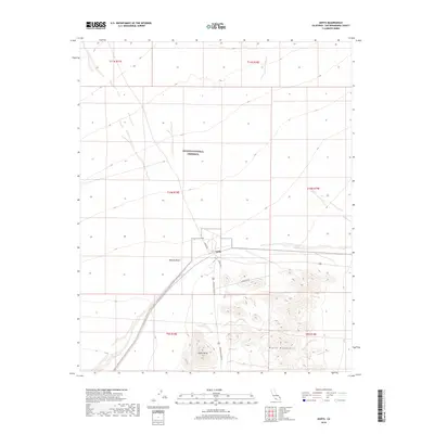
2018 Map of Goffs
USGS Topo · Published 2018About this map
Goffs serves as the central focal point of this arid landscape, situated at a junction of roads and desert trails within the high Mojave Desert. The map documents the relationship between the small settlement and the surrounding Mojave National Preserve, which encompasses much of the northern and western terrain. Local landmarks such as the prominent Goffs Butte and the rising slopes of the Piute Mountains to the southeast define the topography. Transportation routes are sparse but critical, anchored by Lanfair Rd and Mountain Springs Rd. The map illustrates a region where land management boundaries intersect with traditional desert thoroughfares like S Muscrat Trl, providing a clear view of the area's rural character and desert-mountain transitions in the early 21st century.
Find a feature on this map
15 named features on this map. Tap any name to fly to it.
Don’t see what you’re looking for? This feature index may not catch every label — zoom into the map to look around manually.
Map Details
Editions of this 2018 Goffs Map
This is the sole edition of this map. No revisions or reprints were ever made.
Other maps of this area

1886 · Camp Mohave
USGS Topo · 1:250,000

1892 · Camp Mohave
USGS Topo · 1:250,000

1910 · Ivanpah
USGS Topo · 1:250,000

1912 · Ivanpah
USGS Topo · 1:250,000

1926 · Mohave City
USGS Topo · 1:96,000

1942 · Camp Mohave
USGS Topo · 1:250,000

1942 · Ivanpah
USGS Topo · 1:250,000

1942 · Amboy
USGS Topo · 1:250,000

1943 · Amboy
USGS Topo · 1:250,000

1943 · Fenner
USGS Topo · 1:62,500