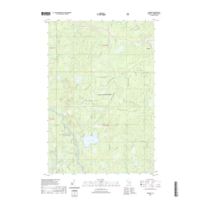
2019 Map of Gogebic
USGS Topo · Published 2019About this map
The Ottawa National Forest dominates this section of the Upper Peninsula, where the landscape is defined by a dense network of glacial lakes and northern river systems. Near the northern boundary, the small settlement of Gogebic sits along the corridor of Old US Hwy 2, while the historic Stage Coach Rd traces a path through the timberlands to the east. The southern portion of the map is punctuated by larger water bodies like Pomeroy Lake and Tenderfoot Lake, which drain into the preserved corridor of the Ontonagon Wild and Scenic River. This survey illustrates the modern management of these public lands, showing numerous forestry and access routes such as the Bluebell Creek Hunter trails. From the headwaters of the Pelton River to isolated basins like Saint Augustine Lake, the map provides a look at a region where recreation and natural resource preservation are the primary human imprints on the land.
Find a feature on this map
38 named features on this map. Tap any name to fly to it.
Don’t see what you’re looking for? This feature index may not catch every label — zoom into the map to look around manually.
Map Details
Editions of this 2019 Gogebic Map
This is the sole edition of this map. No revisions or reprints were ever made.
Other maps of this area

1939 · Trout Lake
USGS Topo · 1:48,000

1946 · Star Lake
USGS Topo · 1:48,000

1946 · Trout Lake
USGS Topo · 1:48,000

1949 · Trout Lake
USGS Topo · 1:48,000

1950 · Star Lake
USGS Topo · 1:48,000

1952 · Thayer
USGS Topo · 1:62,500

1955 · Marenisco
USGS Topo · 1:62,500

1955 · Starlake
USGS Topo · 1:62,500

1955 · Boulder Junction
USGS Topo · 1:62,500

1955 · Marenisco
USGS Topo · 1:24,000