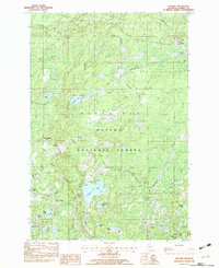
1982 Map of Gogebic
USGS Topo · Published 1983About this map
The Ottawa National Forest dominates this section of the Upper Peninsula, where the Marenisco township meets the waters of the Presque Isle River. In the early 1980s, the landscape was a mosaic of dense timberland and glacial lakes, including Pomeroy Lake and St Augustine Lake. Transportation in this remote area is defined by the Chicago and North Western rail line and several prominent unpaved routes like Pelton Road and Thayer Road.
Find a feature on this map
48 named features on this map. Tap any name to fly to it.
Don’t see what you’re looking for? This feature index may not catch every label — zoom into the map to look around manually.
Map Details
Editions of this 1982 Gogebic Map
This is the sole edition of this map. No revisions or reprints were ever made.
Other maps of this area

1939 · Trout Lake
USGS Topo · 1:48,000

1946 · Star Lake
USGS Topo · 1:48,000

1946 · Trout Lake
USGS Topo · 1:48,000

1949 · Trout Lake
USGS Topo · 1:48,000

1950 · Star Lake
USGS Topo · 1:48,000

1952 · Thayer
USGS Topo · 1:62,500

1955 · Marenisco
USGS Topo · 1:62,500

1955 · Starlake
USGS Topo · 1:62,500

1955 · Boulder Junction
USGS Topo · 1:62,500

1955 · Marenisco
USGS Topo · 1:24,000