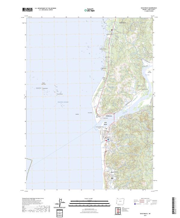
2023 Map of Gold Beach
USGS Topo · Published 2023About this map
The Rogue River meets the Pacific Ocean at the center of this coastal survey, dividing the neighboring communities of Wedderburn and Gold Beach. This region is defined by its complex shoreline, where the Oregon Islands National Wildlife Refuge encompasses numerous offshore landmarks such as Needle Rock, Double Rock, and the Rogue River Reef. The river’s influence extends inland past Johns Hole and Ferry Hole Bar, while the local infrastructure is concentrated around the Curry County Courthouse and the Gold Beach Municipal Airport. For genealogists, several burial sites are documented, including the Pioneer Cem, Rogue Cem, and the Smith Family Cem. To the north, the Geisel Mon stands near Nesika Beach, while the interior terrain rises toward Grizzly Mountain and Tomcat Hill, carved by the various forks of Riley Creek.
Find a feature on this map
79 named features on this map. Tap any name to fly to it.
Don’t see what you’re looking for? This feature index may not catch every label — zoom into the map to look around manually.
Map Details
Editions of this 2023 Gold Beach Map
This is the sole edition of this map. No revisions or reprints were ever made.
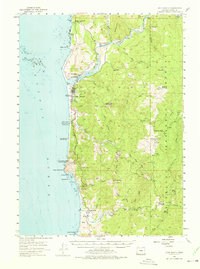
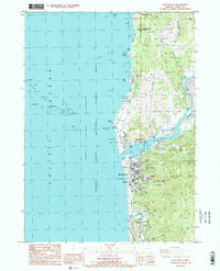
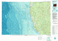
Historical Maps of Gold Beach Through Time
4 maps found