Old Maps of Gold Beach, Oregon
Explore 12 old maps of Gold Beach, spanning from 1954 to today. These high-resolution historic maps reveal how streets, neighborhoods, landmarks, and natural features evolved over time — perfect for genealogy, metal detecting, research, and local history exploration.
What you can do with these maps:
- See how Gold Beach changed over time: Compare historical maps to modern-day views to trace roads, homesites, rail lines & more.
- View detailed metadata: Each map includes creators, publishers, year, scale, and archive source.
- Overlay maps with satellite & LiDAR: Visualize the past alongside modern tools to explore terrain & human change.
- Trusted historical sources: Maps sourced from the USGS, Library of Congress, and other archives.
- Access maps your way: View online, download high-res files, or order prints for personal or research use.
Start exploring old maps of Gold Beach to uncover forgotten places, hidden landmarks, and the deep history beneath your feet.
Gold Beach, OR maps
(12)- 1954 Map of Coos Bay
 1954 Coos Bay1954 Print · USGSCoastal Oregon at mid-century shows a landscape of timber and tides, from the river ports to the edge of the Pacific. Researchers can trace family roots through coastal schools like Beachview School or follow the Southern Pacific RR through Reedsport and Coos Bay.
 - 1954 Map of Gold Beach, 1956 Print
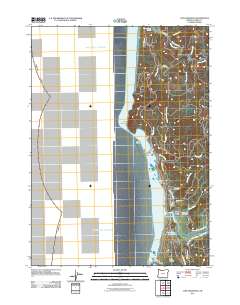
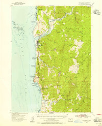 1954 Gold Beach1956 Print · USGSCoastal Curry County in the mid-fifties centers on the maritime and river culture where the Rogue meets the Pacific. Trace the Mailboat Route upriver or locate local landmarks like Wests Mine, Pistol River, and Gardner Ranch.3 unique versions available
 - 1958 Map of Coos Bay, 1974 Print
 1958 Coos Bay1974 Print · USGSThe Southern Oregon coastline at mid-century reveals a bustling maritime and timber economy centered on Coos Bay and North Bend. Researchers can trace the legacy of coastal settlements from Bandon to Brookings, including rail lines of the Southern Pacific RR and the rugged reaches of the Siuslaw National Forest.
 - 1962 Map of Coos Bay
 1962 Coos Bay1962 Print · USGSThe Oregon coast at the end of the fifties reveals a landscape of timber ports and fishing villages connected by U.S. Highway 101. Researchers can trace the rail infrastructure of the Southern Pacific RR and locate early settlements from Florence down to Brookings.2 unique versions available
 - 1986 Map of Cape Sebastian
 1986 Cape Sebastian1986 Print · USGSThe Oregon coast at the mouth of the Pistol River is documented here during the mid-1980s. Researchers can trace local landmarks like the Cem and PO, or explore the limits of Cape Sebastian State Park and Crook Point.
 - 1986 Map of Gold Beach
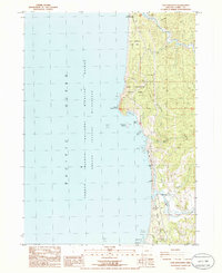
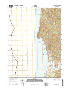
 1986 Gold Beach1986 Print · USGSThe Oregon coast at the mouth of the Rogue River is shown here in the mid-1980s, revealing a landscape defined by maritime heritage and coastal geography. Researchers can trace the river's path through Ferry Hole Bar or locate the historic Miners Fort (Site) and Geisel Monument Wayside.2 unique versions available
 - 1993 Map of Gold Beach
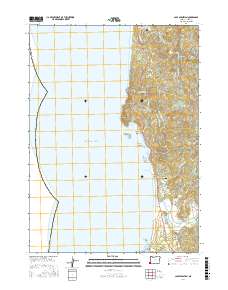
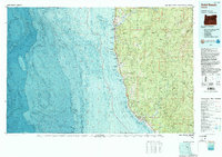 1993 Gold Beach1993 Print · USGSThe Oregon coast at the end of the twentieth century reveals a landscape of river-mouth settlements and deep wilderness. Trace the coastal developments of Gold Beach and Brookings or explore the interior peaks of the Kalmiopsis Wilderness.2 unique versions available
 - 2011 Map of Cape Sebastian, 2011 Print
 2011 Cape Sebastian2011 Print · USGSCovers Gold Beach, including Curry County, United States, and other nearby areas
 - 2014 Map of Cape Sebastian, 2014 Print
 2014 Cape Sebastian2014 Print · USGSCovers Gold Beach, including Curry County, United States, and other nearby areas
 - 2017 Map of Cape Sebastian, 2017 Print
 2017 Cape Sebastian2017 Print · USGSCovers Gold Beach, including Curry County, United States, and other nearby areas
 - 2023 Map of Gold Beach, 2023 Print
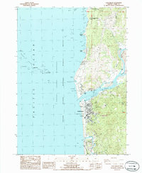
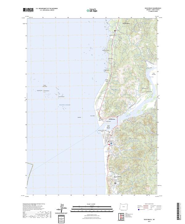 2023 Gold Beach2023 Print · USGSThe mouth of the Rogue River serves as the centerpiece for this modern coastal study of the southern Oregon shore. Researchers can locate family sites at the Pioneer Cem and Smith Family Cem or trace the geography of the Oregon Islands National Wildlife Refuge.
 - 2024 Map of Cape Sebastian, 2024 Print
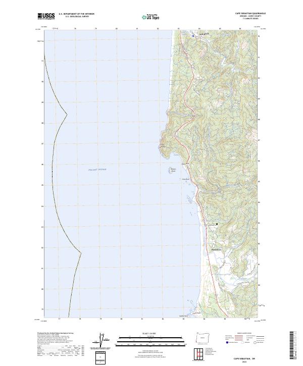 2024 Cape Sebastian2024 Print · USGSThe Oregon coast at Cape Sebastian is shown here in its modern context, from the southern outskirts of Gold Beach down to the mouth of the Pistol River. Researchers can trace old timber infrastructure at the Pistol River Log Pond and find local history at the Pistol River Cem.
End of results
Showing maps 1-12 of 12
Top neighborhoods of Gold Beach
Frequently asked questions
- What are the different types of historical maps available for Gold Beach?
- What is the oldest map of Gold Beach?
- Where can I purchase historical maps of Gold Beach for my home or office?
- Where can I download high-res historical maps of Gold Beach?
- Are there historical topographic maps available for Gold Beach?
- Is there historical aerial imagery available for Gold Beach?
- Where are historical maps of Gold Beach sourced from?