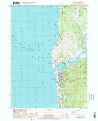
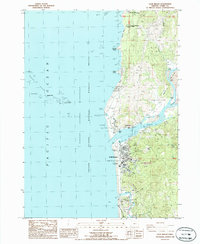
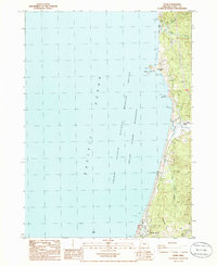
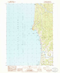
1986 Map of Gold Beach
USGS Topo · Published 1986About this map
The mouth of the Rogue River dominates this coastal survey, where the settlements of Gold Beach and Wedderburn face each other across the wide estuary. This mid-1980s landscape reveals the transition from early pioneer history to a modern service-and-recreation economy. Local history is anchored at the Miners Fort (Site) and the Geisel Monument Wayside, marking the region's mid-19th-century conflicts. The shoreline is defined by its rocky hazards, from the expansive Rogue River Reef and its distinct stacks like Pyramid Rock and Needle Rock to the prominent Otter Point. Along the river, names like Ferry Hole Bar and Johns Hole reflect the traditional importance of the water for transport and fishing. Significant public spaces, including the Curry County Fairgrounds and Collier H Buffington Memorial Park, illustrate the growth of the county seat as a hub for the coastal community.
Find a feature on this map
45 named features on this map. Tap any name to fly to it.
Don’t see what you’re looking for? This feature index may not catch every label — zoom into the map to look around manually.
Map Details
Editions of this 1986 Gold Beach Map
2 editions found
Other maps of this area

1899 · Port Orford
USGS Topo · 1:125,000

1903 · Port Orford
USGS Topo · 1:125,000

1954 · Coos Bay
USGS Topo · 1:250,000
1954 · Port Orford
USGS Topo · 1:62,500
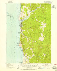
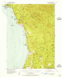
1954 · Gold Beach
USGS Topo · 1:62,500

1958 · Coos Bay
USGS Topo · 1:250,000

1962 · Coos Bay
USGS Topo · 1:250,000
1986 · Ophir
USGS Topo · 1:24,000
1986 · Sundown Mtn
USGS Topo · 1:24,000
1986 · Cape Sebastian
USGS Topo · 1:24,000