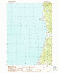
1986 Map of Ophir
USGS Topo · Published 1986About this map
Ophir and Nesika Beach anchor this coastal stretch of Curry County, where the terrestrial landscape meets the protected waters of the Oregon Islands National Wildlife Refuge Wilderness. The topography is defined by sharp elevation changes, from the sea-level expanse of Arizona Beach to the heights of Vondergreen Hill. Inland, the map reveals several significant watercourses, including Mussel Creek, Euchre Creek, and Greggs Creek, which cut through the terrain toward the Pacific Ocean.
Find a feature on this map
25 named features on this map. Tap any name to fly to it.
Don’t see what you’re looking for? This feature index may not catch every label — zoom into the map to look around manually.
Map Details
Editions of this 1986 Ophir Map
This is the sole edition of this map. No revisions or reprints were ever made.
Other maps of this area

1899 · Port Orford
USGS Topo · 1:125,000

1903 · Port Orford
USGS Topo · 1:125,000

1954 · Coos Bay
USGS Topo · 1:250,000

1954 · Port Orford
USGS Topo · 1:62,500

1954 · Gold Beach
USGS Topo · 1:62,500

1958 · Coos Bay
USGS Topo · 1:250,000

1962 · Coos Bay
USGS Topo · 1:250,000
1986 · Father Mountain
USGS Topo · 1:24,000
1986 · Port Orford
USGS Topo · 1:24,000
1986 · Gold Beach
USGS Topo · 1:24,000