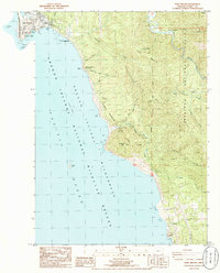
1986 Map of Port Orford
USGS Topo · Published 1986About this map
Port Orford serves as the focal point of this coastal survey, where the rugged Oregon shoreline meets the Pacific Ocean. The town's maritime heritage is evident in the presence of the US Coast Guard Station and the sheltered waters of Tichenor Cove and Nellies Cove. Just north of the main settlement, Garrison Lake sits behind a narrow barrier, while landward features like the local Cem and Battle Rock Wayside (City Park) provide specific points of interest for genealogists and local historians.
Find a feature on this map
47 named features on this map. Tap any name to fly to it.
Don’t see what you’re looking for? This feature index may not catch every label — zoom into the map to look around manually.
Map Details
Editions of this 1986 Port Orford Map
This is the sole edition of this map. No revisions or reprints were ever made.
Other maps of this area

1899 · Port Orford
USGS Topo · 1:125,000

1903 · Port Orford
USGS Topo · 1:125,000

1954 · Coos Bay
USGS Topo · 1:250,000

1954 · Port Orford
USGS Topo · 1:62,500

1954 · Cape Blanco
USGS Topo · 1:62,500

1954 · Langlois
USGS Topo · 1:62,500

1958 · Coos Bay
USGS Topo · 1:250,000

1962 · Coos Bay
USGS Topo · 1:250,000
1986 · Father Mountain
USGS Topo · 1:24,000
1986 · Ophir
USGS Topo · 1:24,000