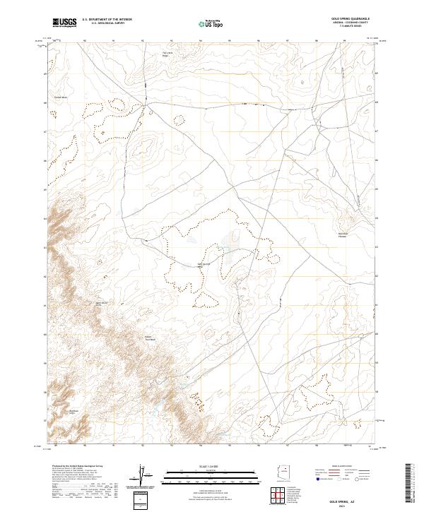
2021 Map of Gold Spring
USGS Topo · Published 2021About this map
Adelii Eechii Cliffs and the Red Rock Cliffs define the high-desert landscape of this corner of Coconino County. The geography is characterized by expansive elevated features like Tohnali Mesa, Sand Springs Mesa, and the Moenkopi Plateau. Water sources, while sparse, are critical anchors for the area, evidenced by Gold Spring, Sand Springs, and Willow Spring. The land is dissected by seasonal drainages such as Paiute Trail Wash and Gold Spring Wash. Apart from Indian Rte 6720, the map shows a landscape largely shaped by its natural topography, including The Little Ridge and Windy Tank. This 2021 survey documents the persistent hydrography and terrain of the high plateaus in the western Navajo Nation region.
Find a feature on this map
19 named features on this map. Tap any name to fly to it.
Don’t see what you’re looking for? This feature index may not catch every label — zoom into the map to look around manually.
Map Details
Editions of this 2021 Gold Spring Map
This is the sole edition of this map. No revisions or reprints were ever made.
Other maps of this area

1883 · Tusayan
USGS Topo · 1:250,000

1886 · Tusayan
USGS Topo · 1:250,000

1886 · San Francisco Mtns
USGS Topo · 1:250,000

1891 · San Francisco Mtns
USGS Topo · 1:250,000

1894 · San Francisco Mtns
USGS Topo · 1:250,000

1899 · San Francisco Mtns
USGS Topo · 1:250,000

1947 · Flagstaff
USGS Topo · 1:250,000

1954 · Flagstaff
USGS Topo · 1:250,000

1958 · Flagstaff
USGS Topo · 1:250,000

1960 · Flagstaff
USGS Topo · 1:250,000