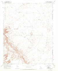
1969 Map of Gold Spring
USGS Topo · Published 1972About this map
The Adeii Eechii Cliffs dominate the southwestern landscape of this 1960s Arizona survey, providing a sharp topographic contrast to the surrounding Navajo Indian Reservation. This high-desert terrain within Coconino County is defined by the vital locations of water sources and the network of paths connecting them. From the Moenkopi Plateau to Tohnali Mesa, the map documents a geography where life revolves around specific reliable points like Gold Spring, Willow Spring, and Windy Tank. Specialized landmarks such as the Salty Water Windmill and the descriptively named Where The Hills End Windmill highlight the essential infrastructure required for survival and navigation in this arid environment. The prevalence of a Jeep Trail network illustrates the remote accessibility of the Sand Springs area during this era, while the Navajo-Hopi Joint Use Area Boundary reflects the complex administrative history of the land.
Find a feature on this map
14 named features on this map. Tap any name to fly to it.
Don’t see what you’re looking for? This feature index may not catch every label — zoom into the map to look around manually.
Map Details
Editions of this 1969 Gold Spring Map
This is the sole edition of this map. No revisions or reprints were ever made.
Other maps of this area

1883 · Tusayan
USGS Topo · 1:250,000

1886 · Tusayan
USGS Topo · 1:250,000

1886 · San Francisco Mtns
USGS Topo · 1:250,000

1891 · San Francisco Mtns
USGS Topo · 1:250,000

1894 · San Francisco Mtns
USGS Topo · 1:250,000

1899 · San Francisco Mtns
USGS Topo · 1:250,000

1947 · Flagstaff
USGS Topo · 1:250,000

1954 · Flagstaff
USGS Topo · 1:250,000

1958 · Flagstaff
USGS Topo · 1:250,000

1960 · Flagstaff
USGS Topo · 1:250,000