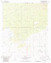
1981 Map of Goldenburg Draw
USGS Topo · Published 1981About this map
The Jornada Experimental Range (USDA) dominates the central landscape of this Doña Ana County survey, where agricultural research meets high-tech military testing. This arid basin is defined by complex water management systems essential for desert survival and operations, featuring widely dispersed points like Wooten Well and Turney Well, alongside numerous catchment basins such as Red Bottom Tank and Restoration Tank. The terrain transitions from the open expanses of Antelope Flat toward the sophisticated infrastructure of the White Sands Test Facility (NASA). Significant natural drainage patterns are traced through Goldenburg Draw and Cottonwood Draw, highlighting the intersection of natural desert topography and the administrative boundaries of the White Sands Missile Range. This era illustrates a unique period when large-scale federal scientific inquiry and aerospace testing redefined the utility of the New Mexico desert.
Find a feature on this map
30 named features on this map. Tap any name to fly to it.
Don’t see what you’re looking for? This feature index may not catch every label — zoom into the map to look around manually.
Map Details
Editions of this 1981 Goldenburg Draw Map
This is the sole edition of this map. No revisions or reprints were ever made.
Other maps of this area

1916 · Tonuco
USGS Topo · 1:125,000

1932 · Tonuco
USGS Topo · 1:125,000

1948 · Chicken Well
USGS Topo · 1:62,500

1948 · Bear Peak
USGS Topo · 1:62,500

1948 · San Diego Mountain
USGS Topo · 1:62,500

1948 · Kaylor Mountain
USGS Topo · 1:62,500

1955 · Las Cruces
USGS Topo · 1:250,000

1958 · Las Cruces
USGS Topo · 1:250,000

1981 · Gilmore Draw
USGS Topo · 1:24,000
1981 · Fleck Draw
USGS Topo · 1:24,000