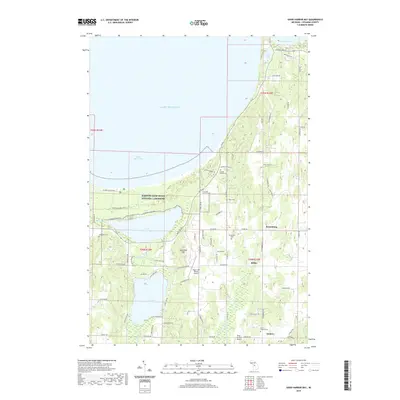
2019 Map of Good Harbor Bay
USGS Topo · Published 2019About this map
Sleeping Bear Dunes National Lakeshore dominates the northwestern coastline of this Leelanau County survey, where the glacial landscape meets Lake Michigan at Good Harbor Bay. The interior is defined by a series of inland waters, including Little Traverse Lake, Lime Lake, and the western reaches of Lake Leelanau. This 2019 edition preserves the rural character of Centerville Township, showing established crossroads like Isadore and Schomberg.
Find a feature on this map
66 named features on this map. Tap any name to fly to it.
Don’t see what you’re looking for? This feature index may not catch every label — zoom into the map to look around manually.
Map Details
Editions of this 2019 Good Harbor Bay Map
This is the sole edition of this map. No revisions or reprints were ever made.
Other maps of this area

1954 · Traverse City
USGS Topo · 1:250,000

1955 · Cheboygan
USGS Topo · 1:250,000

1957 · Traverse City
USGS Topo · 1:62,500

1957 · Northport
USGS Topo · 1:62,500

1957 · Maple City
USGS Topo · 1:62,500

1958 · Cheboygan
USGS Topo · 1:250,000

1958 · Traverse City
USGS Topo · 1:250,000
1983 · Burdickville
USGS Topo · 1:24,000

1983 · Maple City
USGS Topo · 1:24,000
1983 · Gills Pier
USGS Topo · 1:25,000