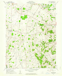
1960 Map of Good Hope
USGS Topo · Published 1962About this map
Good Hope serves as a central hub for this rural landscape in south-central Ohio, situated along the line of the Toledo and Ohio Central RR. The settlement pattern reflects a stable agricultural community, with scattered schoolhouses like the Township Sch and family burial grounds including Eyeman Bryant Cem and Waugh Cem marking the townships of Wayne, Concord, and Buckskin.
Find a feature on this map
49 named features on this map. Tap any name to fly to it.
Don’t see what you’re looking for? This feature index may not catch every label — zoom into the map to look around manually.
Map Details
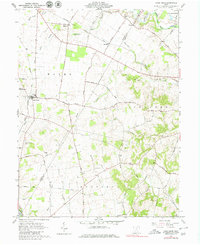
Editions of this 1960 Good Hope Map
2 editions found
Other maps of this area

1906 · Mt Sterling
USGS Topo · 1:62,500

1911 · Era
USGS Topo · 1:62,500

1912 · Roxabell
USGS Topo · 1:62,500

1913 · Era
USGS Topo · 1:62,500

1914 · Roxabell
USGS Topo · 1:62,500

1917 · Greenfield
USGS Topo · 1:62,500

1943 · Era
USGS Topo · 1:62,500

1944 · Greenfield
USGS Topo · 1:62,500

1944 · Roxabell
USGS Topo · 1:62,500

1947 · Columbus
USGS Topo · 1:250,000