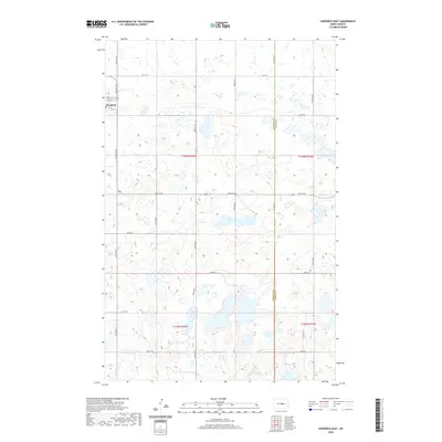
2020 Map of Goodrich East
USGS Topo · Published 2020About this map
Goodrich sits on the western edge of this prairie landscape, where the town grid is defined by streets like Frank St and Front St. This 2020 update, produced from National Agricultural Imagery Program data, captures the complex wetland hydrology of the northern plains, characterized by hundreds of small, unnamed prairie potholes and depressions scattered across the terrain. The map documents the political geography of central North Dakota, centering on the boundary line between Sheridan Co and Wells Co. A network of section-line roads, including 20th Ave NE and Main St E, provides the framework for the agricultural land use that dominates the region. The detailed hydrography, sourced from the National Hydrography Dataset, reflects a landscape where water and land are deeply intertwined, a characteristic feature of this part of the state.
Find a feature on this map
25 named features on this map. Tap any name to fly to it.
Don’t see what you’re looking for? This feature index may not catch every label — zoom into the map to look around manually.
Map Details
Editions of this 2020 Goodrich East Map
This is the sole edition of this map. No revisions or reprints were ever made.
Other maps of this area

1945 · Manfred
USGS Topo · 1:62,500

1946 · Sheyenne Lake
USGS Topo · 1:48,000

1947 · Sheyenne Lake
USGS Topo · 1:62,500

1948 · Manfred
USGS Topo · 1:62,500

1949 · Manfred SW
USGS Topo · 1:24,000

1950 · Manfred SW
USGS Topo · 1:24,000

1952 · New Rockford
USGS Topo · 1:250,000

1954 · McClusky
USGS Topo · 1:250,000

1956 · New Rockford
USGS Topo · 1:250,000

1958 · McClusky
USGS Topo · 1:250,000