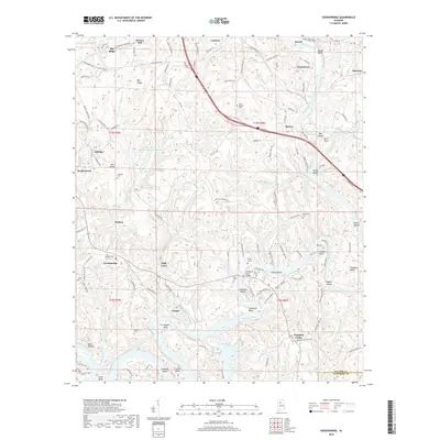
2018 Map of Goodsprings
USGS Topo · Published 2018About this map
The Mulberry Fork winds through this section of the Alabama coalfields, defining a landscape shaped by both river commerce and industrial extraction. Settlements like Goodsprings, Aldridge, and Gorgas are situated among the ridges, while the presence of the Strip Mining Impoundment Number 2 northwest of High Level reflects the area's history of surface mining. The river's serpentine path is marked by numerous named bends and shoals, including Copeland Bend, Brake Bend, and Tuggles Shoals, highlighting the difficult navigation of these waters.
Find a feature on this map
137 named features on this map. Tap any name to fly to it.
Don’t see what you’re looking for? This feature index may not catch every label — zoom into the map to look around manually.
Map Details
Editions of this 2018 Goodsprings Map
This is the sole edition of this map. No revisions or reprints were ever made.
Other maps of this area

1893 · Jasper
USGS Topo · 1:125,000

1935 · Port Birmingham
USGS Topo · 1:48,000

1938 · Port Birmingham
USGS Topo · 1:62,500

1949 · Cordova
USGS Topo · 1:24,000

1949 · Parrish
USGS Topo · 1:24,000

1949 · Sipsey
USGS Topo · 1:24,000

1949 · Jasper
USGS Topo · 1:24,000

1949 · Tutwiler School
USGS Topo · 1:24,000

1951 · Jasper
USGS Topo · 1:24,000
1951 · Parrish
USGS Topo · 1:24,000