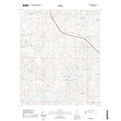
2020 Map of Goodsprings
USGS Topo · Published 2020About this map
Mulberry Fork winds through the heart of the landscape, defining the boundaries of local life and industry along the Walker and Jefferson county line. The river's path is marked by a series of named bends and shoals, from Copeland Bend to Tuggle Bend, reflecting a long history of water-based navigation and riverfront settlement. Significant industrial presence is evident at Strip Mining Impoundment Number 2, which sits north of Drifton.
Find a feature on this map
137 named features on this map. Tap any name to fly to it.
Don’t see what you’re looking for? This feature index may not catch every label — zoom into the map to look around manually.
Map Details
Editions of this 2020 Goodsprings Map
This is the sole edition of this map. No revisions or reprints were ever made.
Other maps of this area

1893 · Jasper
USGS Topo · 1:125,000

1935 · Port Birmingham
USGS Topo · 1:48,000

1938 · Port Birmingham
USGS Topo · 1:62,500

1949 · Cordova
USGS Topo · 1:24,000

1949 · Parrish
USGS Topo · 1:24,000

1949 · Sipsey
USGS Topo · 1:24,000

1949 · Jasper
USGS Topo · 1:24,000

1949 · Tutwiler School
USGS Topo · 1:24,000

1951 · Jasper
USGS Topo · 1:24,000
1951 · Parrish
USGS Topo · 1:24,000