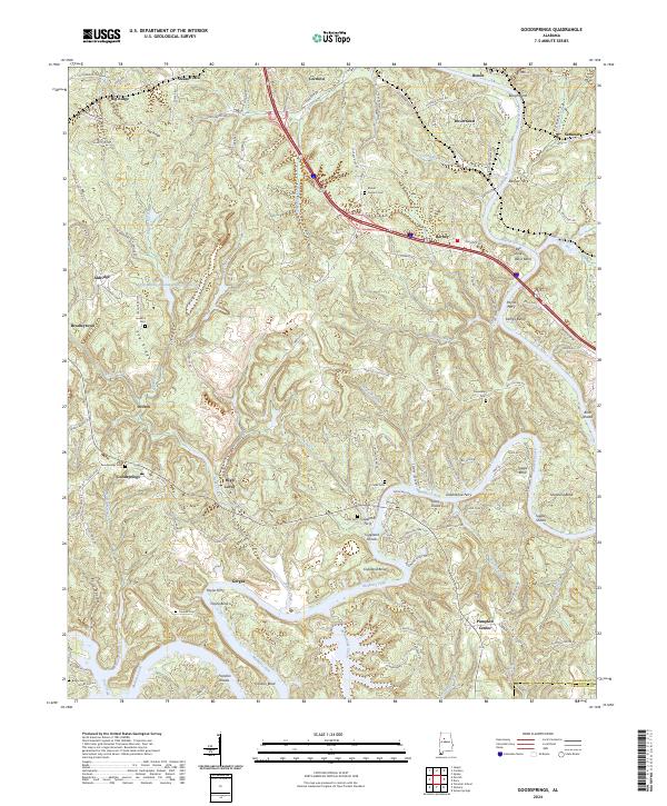
2024 Map of Goodsprings
USGS Topo · Published 2024About this map
The Mulberry Fork winds through this section of Walker County, defining the local geography with its sharp meanders and numerous named shoals. This landscape is shaped by the transition from upland ridges like Big Ridge and Pea Ridge down to the river bottoms, where historically significant crossings such as Copeland Ferry and Underwood Ferry once linked isolated communities. The map highlights a series of small, dispersed settlements including Goodsprings, Gorgas, and Barney, many of which developed around the region's industrial and agricultural needs.
Find a feature on this map
131 named features on this map. Tap any name to fly to it.
Don’t see what you’re looking for? This feature index may not catch every label — zoom into the map to look around manually.
Map Details
Editions of this 2024 Goodsprings Map
This is the sole edition of this map. No revisions or reprints were ever made.
Other maps of this area

1893 · Jasper
USGS Topo · 1:125,000

1935 · Port Birmingham
USGS Topo · 1:48,000

1938 · Port Birmingham
USGS Topo · 1:62,500

1949 · Cordova
USGS Topo · 1:24,000

1949 · Parrish
USGS Topo · 1:24,000

1949 · Sipsey
USGS Topo · 1:24,000

1949 · Jasper
USGS Topo · 1:24,000

1949 · Tutwiler School
USGS Topo · 1:24,000

1951 · Jasper
USGS Topo · 1:24,000
1951 · Parrish
USGS Topo · 1:24,000